

What is Geography: A Basic Guide to its Key Terms and Concepts

Photo by Aaditya Arora from Pexels
By Palwasha Khan (contributing author)
The word geography was derived from Greek words. Geo means “Earth” while graphy means “description”, “study”, or “writing”.
So, geography can be defined as:
“The study of Earth’s physical feature, the various environmental surroundings, and locations as well as their interactions among each other and among people.”
Geography is divided into two main branches:
• Physical: Which deals with the study of physical features of the earth like mountains, plains, and plateaus. Physical geography has many other sub-branches but geomorphology, climatology, hydrology, biogeography are some main branches of physical geography.
• Human: Which deals with the interaction of human beings and their surrounding environment. Cultural geography, economic geography, health geography, historical geography, political geography, population geography, rural geography, social geography, transport geography, and urban geography are some of the branches of human geography.
Key Concepts & terms of Geography:
Geography is a detailed subject, so it has a vast list containing thousands of terms and concepts to understand geography as a discipline. But we will discuss here some major key concepts of geography which will help you to learn basic geographical concepts:
-
Concept of space:
Geographical space is frequently regarded as land with a connection to custody, with space being regarded as ownership or territory. Space is tangible, quantifiable, and definable.
-
Concept of the environment:

Whether biological or social, these refer to the qualities of one’s habitat which may be similar and dissimilar to those of another. People or the surrounding structures make up a cultural environment, for instance.
• Concept of location:
The geographical position, which might be a region of space, a place, or point in space where elements, species, landscapes, or incidents can be discovered, is referred to as location. It might be absolute or relative.
- Absolute: Geometrical location which is represented on the map with the help of exact longitude and latitude, this location will be called absolute location.
- Relative: Relative location is referred to as the location of any point with respect to any other point or place on the globe.
• Concept of change

Any change to the ecological or cultural environment is included. This can be geographical or periodic in nature. In both ecological and cultural contexts, evolution/change is a normal occurrence. It happens at various times, at various rates, and in various locations.
• Concept of inter-connection

Places, as well as the people and organization who inhabit them, are linked to certain other places in a number of ways. These links have a substantial impact on place features and variations in those attributes.
• Concept of sustainability
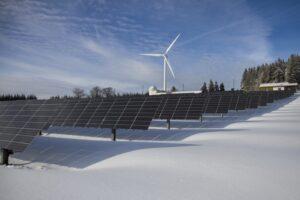
We completely rely on natural resources for all we do. Many resources, on the other hand, are depleting rapidly as they can be replenished. The practice of managing natural resources wisely so that they can support both current and next generations is known as sustainability.
• Concept of scale:
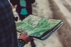
Scale refers to the ratio of the distance shown on the map with respect to the actual distance on the ground. For example, scale depicts that 1-centimeter equals 1 kilometer on the earth.
Some basic terms related to geography:
- North Pole: The North Pole is the outermost North point situated in the northern hemisphere. It is at 90 degrees from the equator
- Latitude: Latitudes are the parallel, horizontal imaginary lines on the north and south of the equator, dividing the globe into equal parts horizontally.
- Longitude: Longitudes are the parallel, vertical imaginary lines on the east and south of prime meridian, dividing the globe into equal parts vertically.
- Altitude: The vertical measurement above the level of the sea is referred to as altitude.
- Humidity: Humidity is the term for the wetness present in the air. This wetness is caused by the presence of water vapors suspended in the environment.
- Topographic Map: A map that shows where geographical features are situated on the earth’s surface. Mountains, lowlands, plain terrain, plateau, watercourses, and other geographical characteristics are examples.
- Geothermal: It is the heat energy that evolves from the surface of Earth.
- Landslide: A landslide is the slipping down of a soil mass or rocks from a mountainside or cliff.
- Deforestation: Slicing down trees and removing forests for human benefit is called deforestation. It is a criminal act.
- Cartography: It is the skill of drawing maps on a paper
Importance of studying geography:
Geography is a vast discipline that cannot be explained in a single piece of an article, but you will get enough basic info from this article. Studying geography will help us to understand the geographical history of the planet, its landscapes, and cultures along with their interaction with each other. Moreover, the study of geography makes you able to understand map and navigation skills, which will help you to experience better traveling. As well as it will also help to understand urban globalization and to grow more active and efficient, in an interconnected society by learning about all of the areas on the planet, as well as their physical and natural aspects.












Responses